Maps are drawn to a scale. Map scales are either given as a ratio, such as 1:2500, or given as a measured distance on the map representing an actual distance, such as 1 centimetre represents 5 kilometres.
The measured distance can be changed to a ratio by writing the comparison in the same units.
What, in real life, is the distance from Ardley to Elvinside? On the map, 2cm represents 5km.
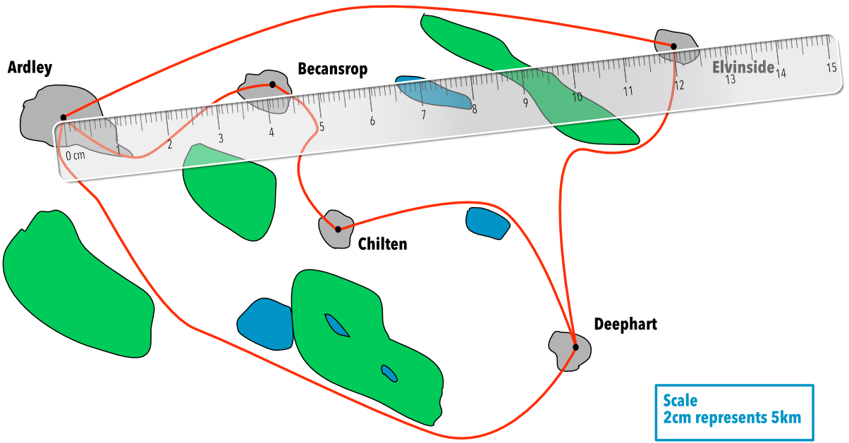
The ruler measures 12cm.
On the map, 1cm represents 5 ÷ 2 = 2.5km.
12 x 2.5 = 30km.
Answer: 27.5km
What should the ruler measure, if the straight-line distance from Ardley to Becansrop is 10.75km in real life?
Divide 10.75km by 5 = 2.15
Multiply by 2 = 4.3 cm
Answer: 4.3 cm